Expert Bushfire Assessment Services in Wollondilly
Harris Environmental, one of Australia's leading and most established environmental consulting firms, provides professional services in Wollondilly. We provide Bushfire Assessment services in Wollondilly to help you ensure all your developments and properties comply with the latest safety and planning codes, and to promote sustainable land management.
Why Bushfire Assessments Are Essential in Wollondilly
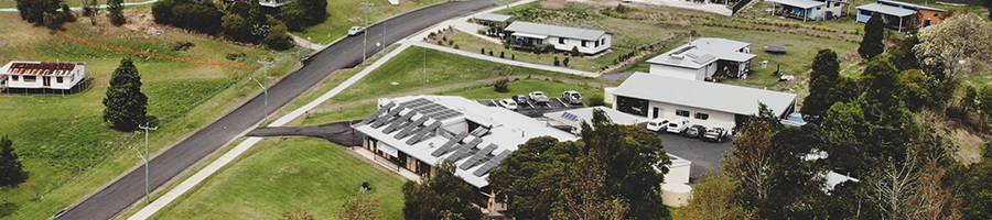
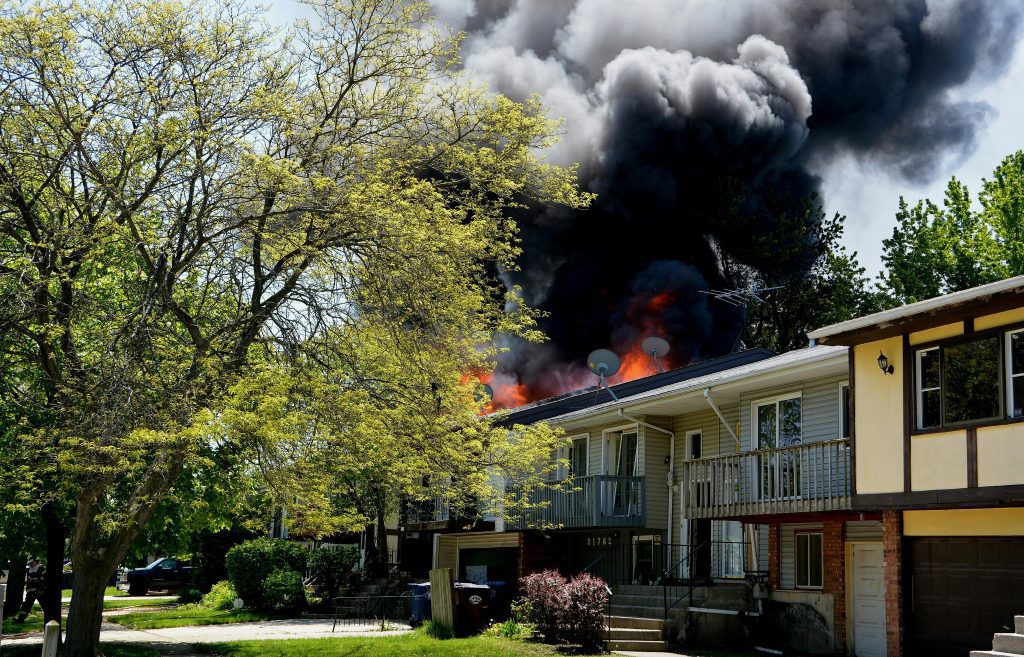
Wollondilly’s semi-rural landscape, with its mix of bushland, rolling hills, and rural properties, faces a higher bushfire risk during the warmer months. Many parts of the region border bushfire-prone areas, making it essential for homeowners and developers to take proactive measures to protect lives and properties.
Are you building, renovating, or managing land in Wollondilly? If so, you need to understand bushfire risk. A bushfire assessment will assess how likely it is for a bushfire to occur and will assist you in planning your buildings and landscapes to mitigate vulnerability and protect lives.
A bushfire hazard assessment will look at the specific fire risks in your area, such as evaluating: The amount of flammable vegetation on your properties, the geography or slope of the land, and how this plays a role in fire spreading, the availability of emergency services, and how far such services are. We will work with local landowners and authorities to develop plans to reduce risk, promote safety, and enable sustainable land management.
Our Bushfire Assessment Process
Site Inspection and Risk Evaluation
Our consultants conduct on-site inspections across Wollondilly to assess your land, vegetation, and terrain conditions. We evaluate bushfire risk factors such as fuel loads, slope, and proximity to fire-prone areas.
Bushfire Hazard Identification and Reporting
After assessment, we prepare a detailed Bushfire Assessment Report that identifies potential fire hazards and recommends mitigation strategies tailored for your property and Wollondilly’s local conditions.
Compliance with NSW Planning and Safety Codes
Every assessment and report is developed in accordance with NSW Rural Fire Service (RFS) and Planning for Bushfire Protection (PBP) guidelines — ensuring full compliance with Wollondilly Council requirements.
Why Choose Harris Environmental
- Local Expertise: We understand how bushfires behave across Wollondilly’s bushland and semi-rural zones.
- Tailored Solutions: Our assessments are designed specifically for your site and development needs.
- Comprehensive Services: Beyond bushfire assessments, we also provide ecological, soil, and stormwater consulting to support your full project lifecycle.
- Proven Results: With over 20 years of experience, we’ve supported homeowners, developers, and government projects across NSW.
Need a Bushfire Assessment in Wollondilly?
If you’re planning a new development or renovation in the Wollondilly area, ensure your project is compliant, safe, and sustainable.
Harris Environmental provides reliable, professional, and council-ready Bushfire Assessment services to help you move forward with confidence.
FAQs - Bushfire Assessment Wollondilly
Q1: How long does a bushfire assessment take?
Typically, assessments are completed within 1–2 weeks depending on the site’s size and complexity.
Q2: Is a bushfire assessment required for development applications (DA)?
Yes. Most developments in Wollondilly require a bushfire assessment under NSW legislation.
Q3: Can my Bushfire Attack Level (BAL) rating be reduced?
In many cases, yes. We can recommend vegetation management or design adjustments that may lower your BAL rating.
Q4: What happens if I skip a bushfire assessment?
Omitting an assessment can lead to DA delays, non-compliance penalties, or increased risk to your property and occupants.
Q5: Do you offer ongoing fire mitigation support?
Yes. We provide guidance on vegetation management, firebreaks, and sustainable land practices to reduce long-term fire risks.